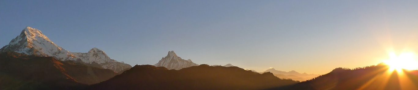
Sagarmatha(Everest) National Park covers an area of 1148 square kilometers in the Khumbu region of Nepal. The Park includes the highest peak in the world. Mt. Sagarmatha (Everest 8848 m.) and several other well known peaks such as Lhotse, Cho Oyu, Pumori, Ama Dablam, Thamerku, Kwangde, Kangtaiga and Gyachyung Kang.
As Mt. Sagarmatha and the surrounding area is of major significance not only to Nepal but to the rest of the world, its status as a national park since 1976 is intended to safeguard its unique cultural, physical and scientific values through positive management based on sound conservation principles.
Geology
According to the continental-drift theory, the Himalaya were uplifted at the end of the Mesozoic Era, some 60 millions years ago. The resulting young mountains of this region are still rising and the net growth is a few centimeters per century.
Local Inhabitabts
The park is populated by approximately 3000 of the famed Sherpa people, originating from Tibet in the late 15th or early 16th century A.D. Their lives are interwoven with the teaching of Buddhism. The main settlements are Namche Bazaar, Khumjung, Khunde, Thame, Thyangboche, Pangboche and Phortse. There are also temporary settlements in the upper valleys where the Sherpas graze their livestock during the summer season.
The economy of the Khumbu Sherpa community has traditionally been agriculture, livestock herding and trade with Tibet. With the coming of international mountaineering expeditions in the 1950s, the region also attracted larger numbers of foreign trekkers. Today the Sherpa economy is becoming increasingly dependent on tourism.
Seasons:
From mid-October to mid-December and from mid-February until mid-April the weather is usually clear but cold at higher elevations. From mid-April to mid-June, it is warm but often cloudy with thunder showers, spring flowers are at their best. Summer monsoon lasts until the beginning of October. During the winter months daytime temperatures are low and snow may occur even at low levels.
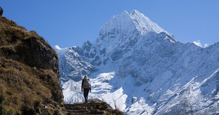
Tourist Attractions:
Vegetation
Vegetation in the park varies from pine and hemlock forests at lower altitudes, fir, juniper, birch and rhododendron woods at mid-elevations, scrub and alpine plant communities higher up and bare rock and snow above tree line. The famed bloom of rhododendrons occurs during the spring (April and May) although much of the. flora is most colorful during the monsoon season (June to August). .
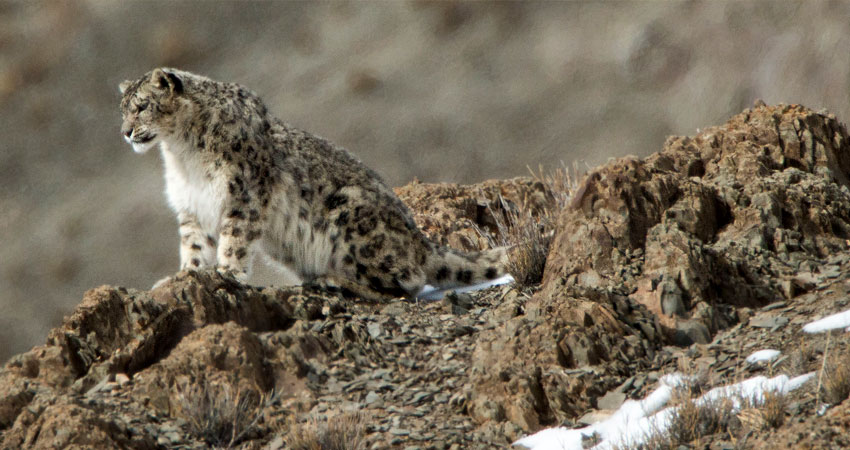
Wild Animals
The wild animals most likely to be seen in the park are the Himalayan tahr, goral, serow, musk deer and Himalayan black bear. Other mammals are weasels, martens. Himalayan mouse hare (Pika), jackals and langur.
Birds
The park provides a habit for at least 118 species of birds. The most common birds to be seen are the Impeyen pheasant (the national bird of Nepal), blood pheasant, cheer pheasant, jungle crow, red billed and yellow billed coughs and snow pigeon. Fairly common birds are the Himalayan griffon, lammergier, snow partridge, skylark and many others.
Important Points:
The park Headquarters is at Dhunche, and a check post at Ghora Tabela. All visitors must stop at either place to pay an Entrance Fee, and are required to show your passport.